Into the Abyss: The 1956 Grand Canyon Mid-air Collision
Note: this accident was previously featured in episode 11 of the plane crash series on November 18th, 2017, prior to the series’ arrival on Medium. This article is written without reference to and supersedes the original.

On the 30th of June 1956, a fateful sequence of events in the skies above Arizona changed aviation forever. Two airliners from two major US carriers came together at 21,000 feet over the Grand Canyon, sending both planes spiraling into the abyss, shattered upon the slopes of America’s most iconic natural wonder. With no flight recorders, no witnesses, no radar records, no survivors, and one of the most inhospitable crash sites in the history of commercial aviation, investigators faced the seemingly impossible task of reconstructing what happened and why. But through a combination of detailed forensic analysis and experienced reckoning, they managed to come to a startling conclusion: that the accident was not the fault of either crew, but of the air traffic control system itself, which was increasingly unable to guarantee the safety of the growing number of airplanes crisscrossing the skies over the United States. The fallout from the disaster in the Grand Canyon, and the groundbreaking inquiry which followed it, would fundamentally transform the way we fly.
◊◊◊
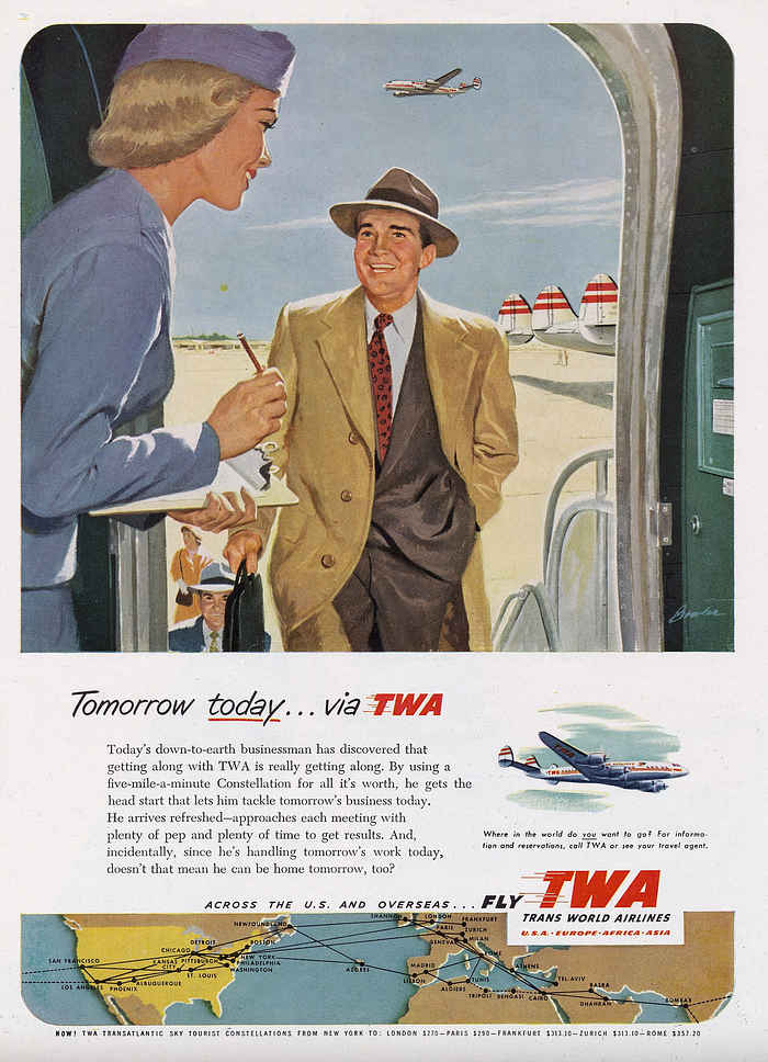
The 1950s were in many ways the golden age of American capitalism. Huge numbers of people rose into the middle class, revolutionary new products flooded into American homes, and enormous infrastructure projects connected the east and west coasts in ways that would have been unimaginable a few decades before. Commensurate with this post-war economic boom came a massive increase in air travel, as more people could afford the tickets; new, larger planes could carry more passengers; and safety innovations led to the abandonment of the notion that flying was inherently dangerous. But, just as the boom times belied the unequal distribution of the country’s newfound wealth, the sudden success of commercial flight obscured a crucial shortcoming: America’s aviation infrastructure was still geared toward the realities of an earlier era.
Until about 1950, the skies over the United States were mostly uncontrolled: a big, empty expanse where no one was watching and there was nothing to hit. The number of planes in the air at any one time was so low that the possibility of a collision outside of the relatively congested airspace near major airports was all but unthinkable. Radar had recently been installed in large cities to assist controllers in these areas, but it was only in 1950 that authorities instituted a system of designated airways based on navigational aids with standard traffic rules and rights of way. This system was a reaction to a rapid increase in the number of airplanes in the United States, but it only covered the relatively more populous East and Midwest. Beyond the 100th meridian, where the Western United States is considered to begin, air traffic retained the right to fly anywhere and at any altitude, mainly due to the lower density of airplanes and airports. Large sections of the West were what is known as uncontrolled airspace, where controllers did not actively monitor the positions of aircraft, except to prepare for their eventual entry back into a controlled sector. One of the largest of these areas stretched across much of Arizona, Nevada, and Utah, an enormous expanse of mostly empty desert which also encompassed the cities of Las Vegas and Phoenix, both of which at that time had less than one fifteenth of their present population.
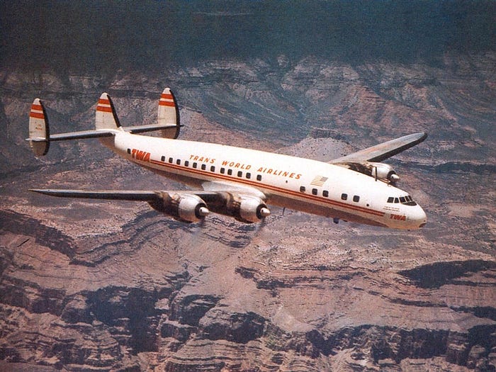
Any flight intending to travel between the coastal cities of Southern California and places east had to pass through this zone, and Trans World Airlines flight 2, a regularly scheduled flight from Los Angeles to New York with a stop in Kansas City, Missouri, was to be no exception. Operating this flight on the 30th of June 1956 was a Lockheed L-1049 Super Constellation nicknamed Star of the Seine, a distinctive triple-tailed, four-engine giant capable of carrying around 100 passengers non-stop from coast to coast. In command of the Constellation, which was often compared favorably with a flying fish, was Captain Jack Gandy, a highly experienced TWA pilot who had more than 15,000 flight hours and had flown between Los Angeles and Kansas City 177 times. He was joined that day by First Officer James Ritner, Flight Engineer Forrest Breyfogle, two flight attendants, a second deadheading flight engineer, and 64 passengers, totaling 70 people on board.

A couple of minor mechanical problems delayed their departure for Kansas City, but at 9:01 a.m. the Constellation took to the skies, heading east via a pair of local airways before the transition to uncontrolled airspace. On the taxiway at Los Angeles International Airport, the crew of United Airlines flight 718 to Newark via Chicago and Philadelphia watched it depart, unaware that their two airliners would soon be caught in a fateful chain of events that would lead to the deaths of everyone on board.
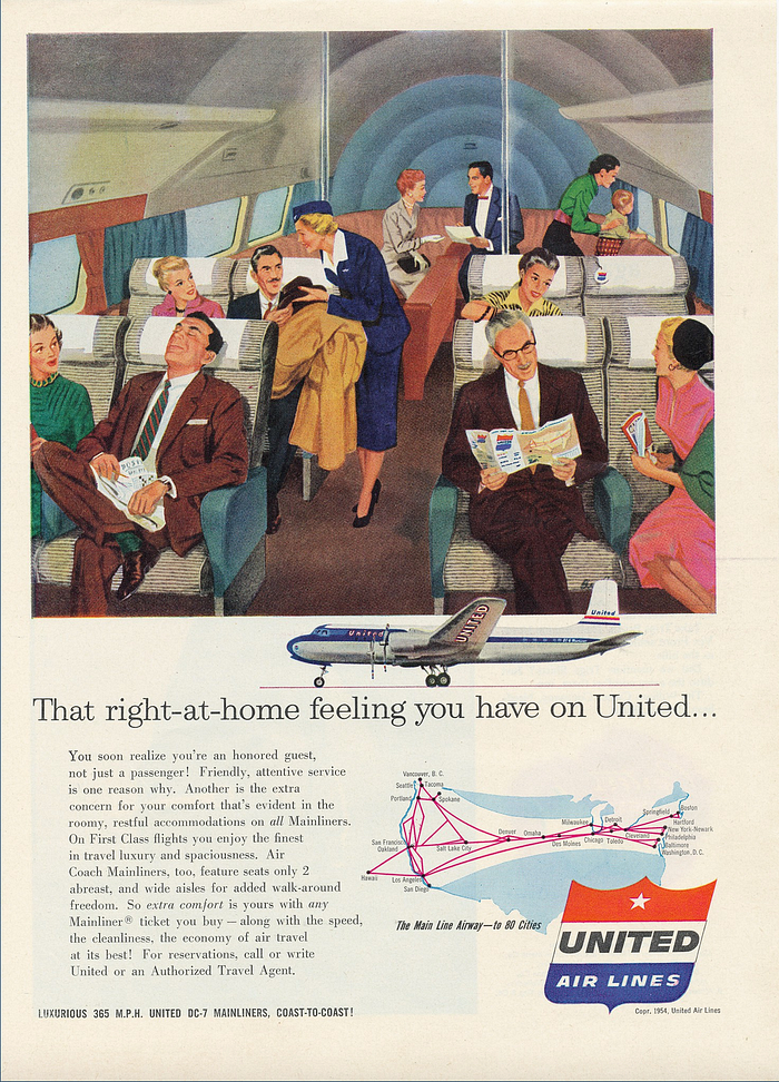
The United flight was a Douglas DC-7, the latest long-range, four-engine model from the Douglas Aircraft Company, nicknamed Mainliner Vancouver. In command was Captain Robert “Bob” Shirley, a veteran pilot with 17,000 hours, as well as First Officer Robert Harms and Flight Engineer Gerard Fiore. Two flight attendants and 53 passengers made for a total of 58 people on board, well short of its maximum capacity. After taxiing into position and receiving clearance for takeoff, flight 718 also departed Los Angeles, three minutes behind the Constellation.
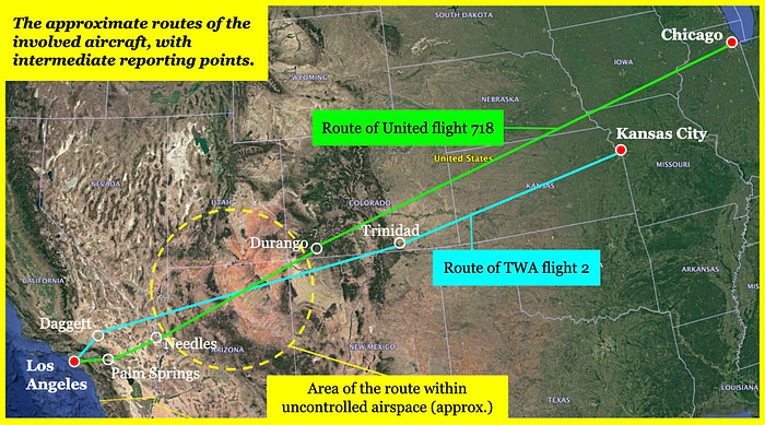
TWA flight 2 and United flight 718 initially took different routes following takeoff. The TWA Constellation first proceeded northeast toward Daggett, California, followed by a slight right turn direct to Trinidad in southern Colorado, on the other side of the uncontrolled airspace. The United DC-7, for its part, planned to head east to Palm Springs, turn northeast to Needles on the California-Arizona border, then proceed to Durango, also in southern Colorado. Their paths would cross somewhere over northern Arizona, near an imaginary reporting point known as the Painted Desert Line. Stretching across an extremely remote swathe of desert riven by canyons and barren plateaus, the 280-kilometer-long Painted Desert Line connected Bryce Canyon, Utah and Winslow Arizona, and was used by east-west traffic in the region to give controllers some sense of a flight’s progress across the uncontrolled airspace.
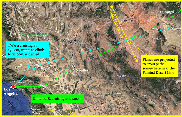
At that time, aircraft did not speak directly to controllers while en route. Instead, both United 718 and TWA 2 communicated with company radio operators on the ground who then relayed their messages to regional control centers, an archaic system which dated back to the earliest days of the concept of air traffic control. So when Captain Gandy aboard the TWA Constellation requested a flight level change at 9:21, his request became the object of a veritable game of telephone.
Cruising at 19,000 feet, Gandy reported that he was approaching Daggett and wanted to climb to 21,000 feet to get on top of some weather which was beginning to build up over Arizona.
“TWA 2 is coming up on Daggett, requesting 21,000 feet,” the company radioman repeated to the Los Angeles area controller.
Upon receiving the message, the Los Angeles controller asked his counterpart in Salt Lake City, Utah, who was responsible for the airspace over northern Arizona, what he thought of the situation. “TWA 2 is requesting two one thousand, how does it look?” he asked. “I see he is Daggett direct Trinidad, I see you have United 718 crossing his altitude — in his way at two one thousand.”
“Yes, their courses cross and they are right together,” the Salt Lake controller replied.
The Los Angeles controller then called back the TWA radio operator and said, “Advisory, TWA 2, unable to approve two one thousand.”
But the operator immediately butted in with a new request: “Just a minute, I think he wants one thousand on top,” he said. “Yes, a thousand on top until he can get it.”
Although the concept has long since been abolished, in 1956 a pilot could request a clearance to fly “1,000 on top” of the clouds. Although the official guidelines were somewhat contradictory, in practice this meant that the flight would switch to visual flight rules, or VFR, in which the pilot is responsible for their own navigation and separation from other aircraft, and must stay at least 1,000 feet away from any clouds, climbing or descending to whatever altitude is required in order to do so. (This is as opposed to instrument flight rules, or IFR, in which the plane is cleared to a particular altitude and course and navigates via ground-based aids.) Today, an airliner “going VFR” while en route would be extremely rare, although the practice survives among light aircraft at low altitudes. But in 1956 airliners regularly requested and received such clearances, even at altitudes near or above 20,000 feet, which is no longer legal in the United States. In fact, by requesting 1,000 on top, Captain Gandy could effectively fly at whatever altitude he wanted, so long as he stayed away from the clouds.
It just so happened that on that particular day and in that particular area, 1,000 feet above the clouds meant 21,000 feet above sea level, the same height for which Gandy had just been denied clearance. But his request was entirely in line with existing rules, so the Los Angeles controller said to the TWA radio operator, “ATC clears TWA 2, maintain at least one thousand on top. Advise TWA 2 his traffic is United 718, direct Durango, estimating Needles at 9:57.”
The radio operator repeated the clearance, adding that United 718 was at 21,000 feet, and Captain Gandy replied, “Traffic received.”
Continuing east, both planes passed out of controlled airspace and into the Salt Lake Flight Advisory Area. At 9:58, the crew of United 718 reported passing over Needles at 21,000 feet and estimated that they would cross the Painted Desert Line, the next reporting point, at 10:31. Due to an interphone glitch, the radio operator only managed to pass this information to the Salt Lake controller at 10:13.
One minute later, at 9:59, TWA flight 2 reported passing over Lake Mohave at 21,000 feet, also estimating Painted Desert at 10:31. This report reached Salt Lake at 10:01, twelve minutes before the transmission from United 718. The Salt Lake controller now knew that both planes were at the same altitude and expected to reach the Painted Desert Line at the same time. But because the two planes could cross the 280-kilometer-long Painted Desert Line at any point along its length, and could change altitude at any time, the controller had no way of knowing whether the planes were at risk of colliding — and it was uncontrolled airspace, so he was not responsible for separating them anyway. That responsibility belonged to the pilots.
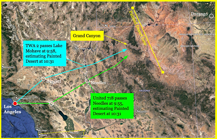
As it turned out, neither plane was taking the most direct route to the Painted Desert Line. Both had deviated to the north, falling three minutes behind their estimated arrival times, for reasons which cannot be known with certainty. But it is widely believed, particularly by those who flew in that era, that the two crews both decided independently to give their passengers a bird’s eye view of the Grand Canyon.

Ranging between 6 and 29 kilometers in width and over a mile deep, the Grand Canyon stretches for 446 kilometers across northern Arizona, tearing the red earth asunder in a labyrinth of sheer cliffs, hidden cul-de-sacs, mighty buttes, and precarious towers. The canyon, designated a National Park in 1919, is considered one of the world’s preeminent natural wonders, and by the 1950s airline pilots had become accustomed to using the freedom afforded to them in uncontrolled airspace to show off the canyon to their passengers. At that time, attracting passengers was not a race to the bottom as it is today, but a race to the top, in terms of what the airlines could offer. Sightseeing detours, especially to the Grand Canyon, were an easy method to convince Americans — the majority of whom had never been on an airplane — to fly instead of driving or taking the train.
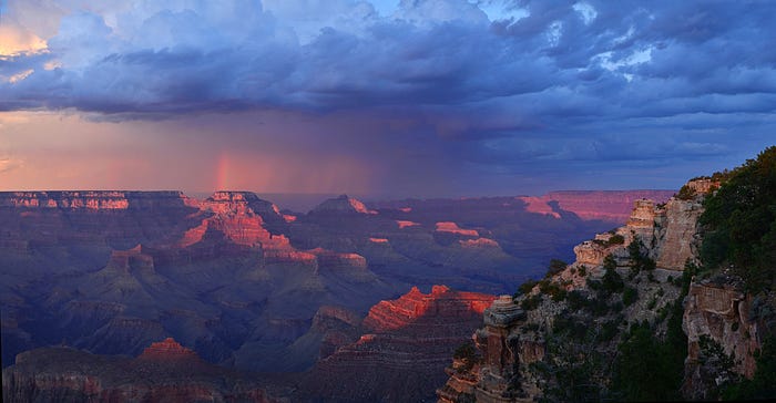
However, the weather over the Grand Canyon that day was not clear. In fact, it was mostly overcast, with a few gaps peeking through between towering thunderheads which stretched up to 30,000 feet. Investigators would later consider the possibility that the two planes’ deviation to the north might have been to avoid these storms. But regardless of whether they were trying to catch a glimpse of the Grand Canyon or simply trying to stay clear of the clouds, both planes doubtlessly needed to make several calculated turns in order to keep away from the huge, gray anvils, which likely contained strong turbulence, hail, and other hazards. It turned out that these cloud formations had another unfortunate side effect: they interfered with the ability of the two crews to see each other. In uncontrolled airspace, they were responsible for “seeing and avoiding” one another, but in this weather environment, it might have been impossible to do so. And amid their efforts to find a clear path, neither crew had any way of knowing that the two planes were on a collision course.
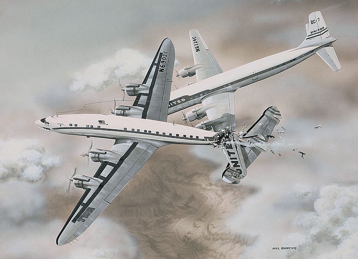
No one knows exactly when the United crew saw the TWA Constellation ahead of them, if they saw it at all. Maybe they came around a cloud and there it was, right in their path, appearing out of nowhere only once it was already too late. Or maybe it was there to be seen all along, but the pilots were distracted looking at their instruments and never saw it. One wonders, did they try to avoid the fateful collision? Here too, there are no certain answers, but the evidence at least raises the possibility that they did. What is known is that sometime between 10:30 and 10:31, United Airlines flight 718 slammed into TWA flight 2 from behind and to the right, in a 20-degree right bank, pointed between five and ten degrees nose down. The left wingtip of the United DC-7 struck the center fin on the Constellation’s triple tail and sliced straight through the rear fuselage; simultaneously, the DC-7’s number one propeller ripped open the underside of the Constellation’s aft baggage compartment. The catastrophic collision, lasting less than half a second, instantly crippled both aircraft beyond all hope of recovery.
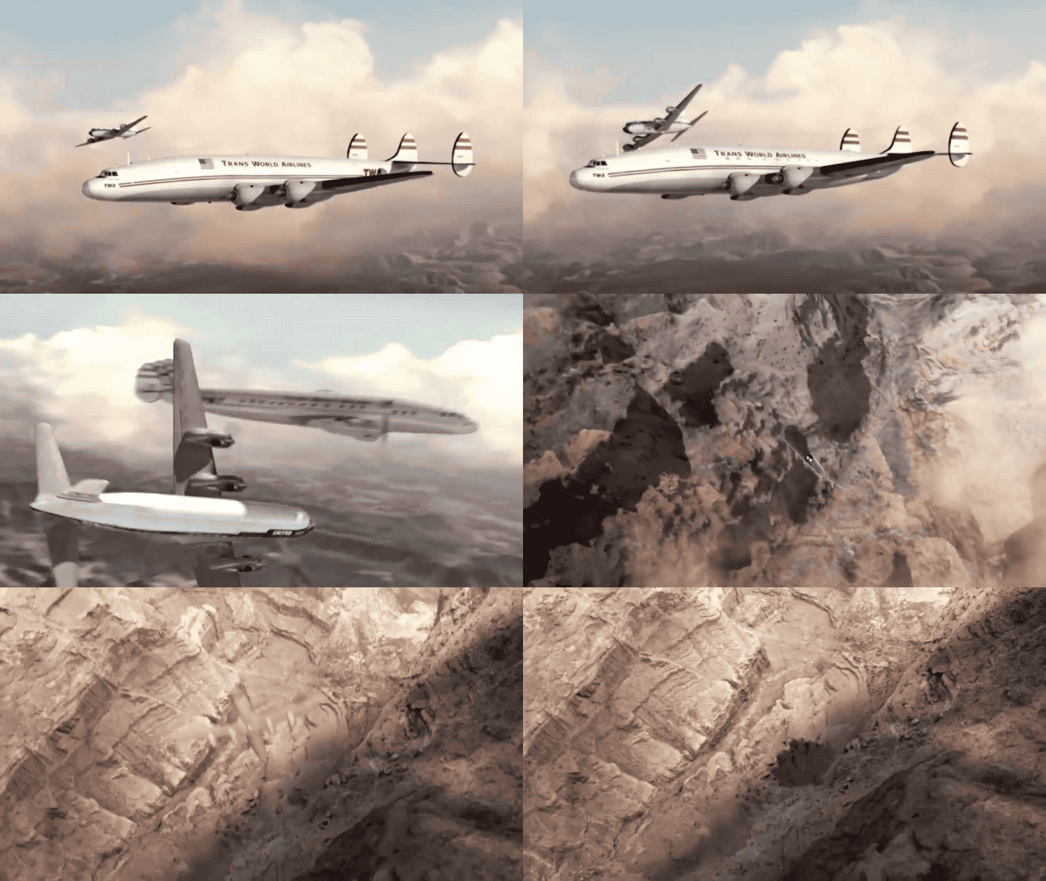
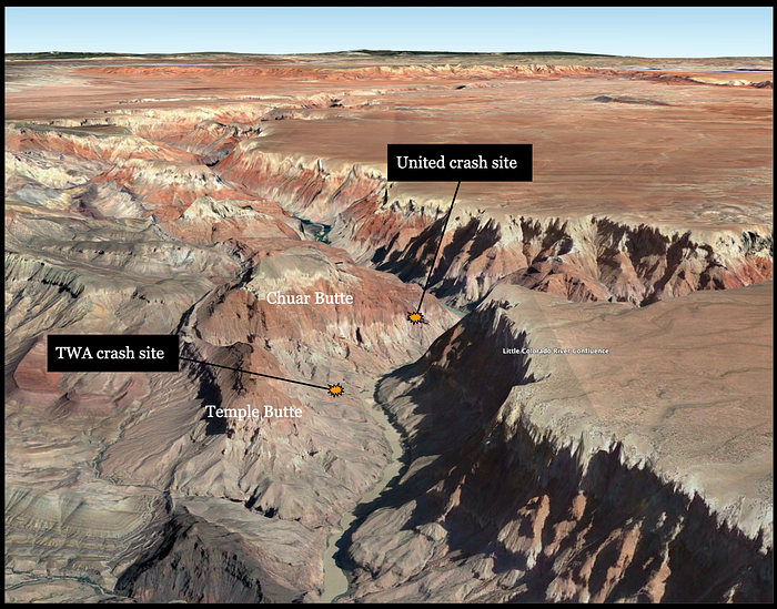
Within a split second of the collision, the tail section of the Constellation ripped away, and the plane entered a near vertical dive, plunging directly into the Grand Canyon from 21,000 feet. Spewing passengers and light debris out into the sky, it passed through 90 degrees nose down and kept falling inverted, until it finally slammed upside-down into a steeply sloping hillside 130 meters above the Colorado River, obliterating the aircraft and instantly killing all 70 people on board. Captain Gandy and his crew likely never knew what hit them.
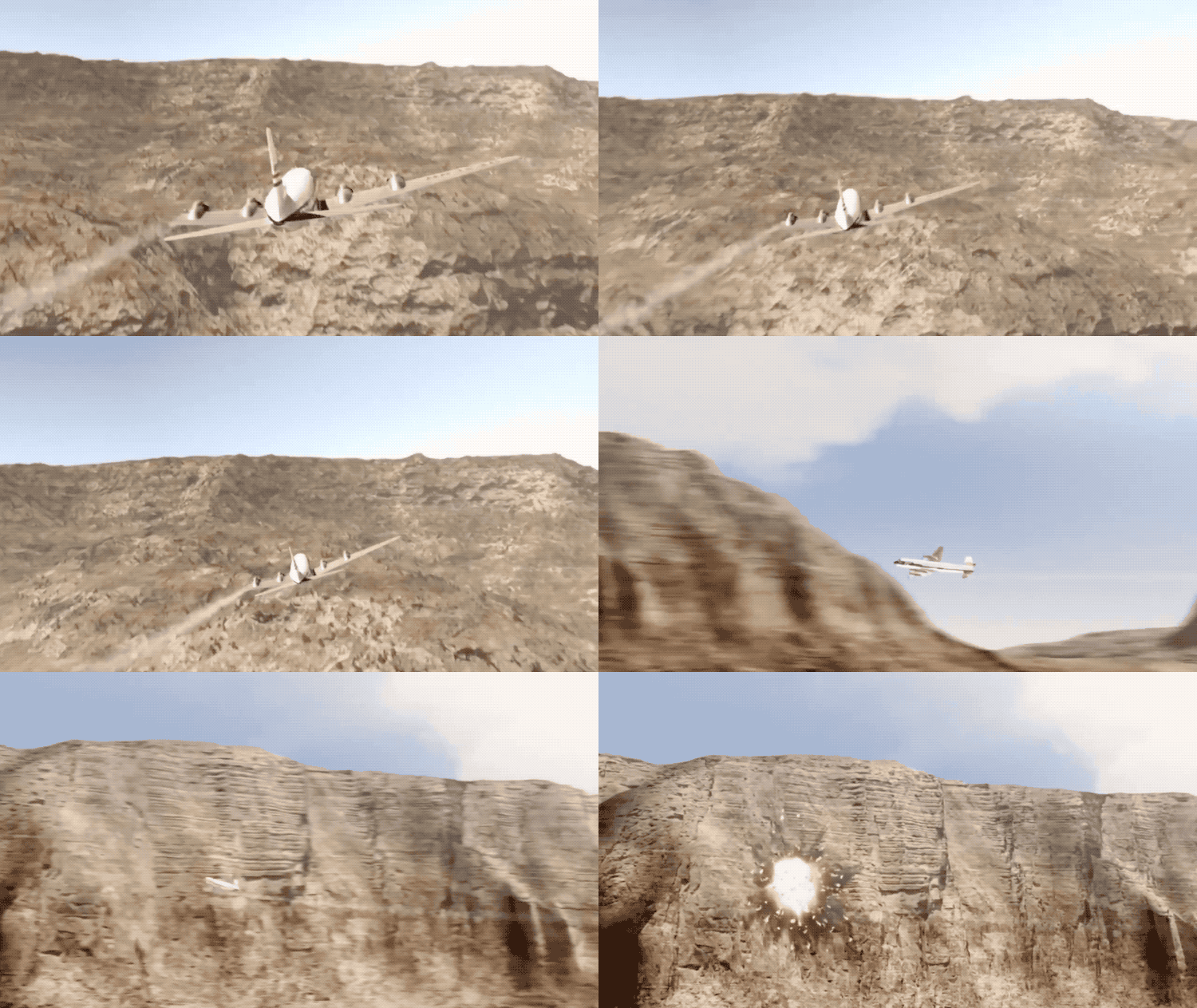
The fate of United 718 was more drawn out, but no less dire. Having lost six meters off its left wing, the DC-7 entered a prolonged leftward spiral, descending at a high rate of speed toward the yawning chasm below. With such terrible damage, the plane would have been uncontrollable. First Officer Harms managed to broadcast one panicked message to the company operator: “Salt Lake area, seven eighteen, we are going in!”
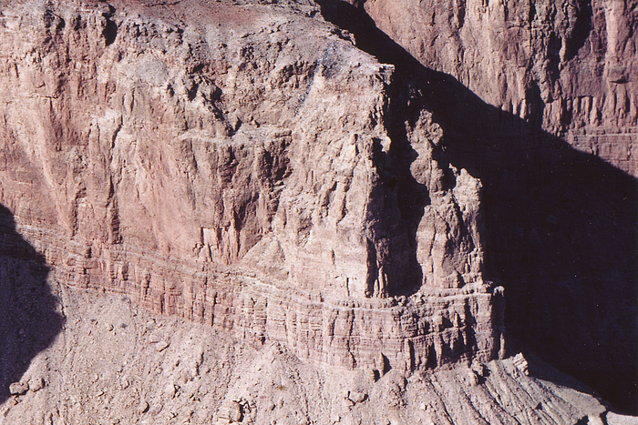
In the background, Captain Shirley yelled “come up” or “pull up,” his voice shrill with terror. The time was 10:30 and 53 seconds. Moments later, her pilots likely fighting to the end, United 718 slammed into a buttress-like promontory protruding from the nearly 1,000-meter-high sheer face of Chuar Butte, sending burning debris ricocheting off the cliff and down a dark crevasse. For the 58 passengers and crew, as for their counterparts aboard the Constellation, there was no hope of survival.
◊◊◊
Salt Lake City controllers did not receive the garbled distress call from United 718, which was sent to the company operator, but within an hour it became clear that something was wrong when both planes failed to report passing the Painted Desert Line and could not be raised by radio on any frequency. As it dawned on the controllers that something terrible must have happened, a search and rescue mission was launched, scouring the desert by air in a futile search for some sign of the wreckage. With no radar record and no precise knowledge of either plane’s last reported position, searchers planned to rely on tips from people who may have witnessed the crash, but in the vast wilderness of northern Arizona, they could not find any reliable witnesses either.
It turned out that shortly after the accident, the Hudgin brothers, owners of the sightseeing tour operator Grand Canyon Airlines, had earlier that day spotted two columns of smoke rising from a remote area near the confluence of the Colorado and Little Colorado rivers in the eastern part of the canyon. Not having heard about the crash, they assumed the smoke came from a brush fire; only after their return to their home base at Grand Canyon Airport did they learn of the missing airliners. As dusk fell over the desert, they returned to the scene in their light aircraft, where they managed to spot the distinctive triple tail of the Constellation lying on a hillside above the Colorado River. Although the onset of night left no time to investigate the presumed crash site of the United DC-7, there was no doubt that this was the place where the two airliners had fallen to earth.
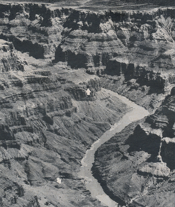
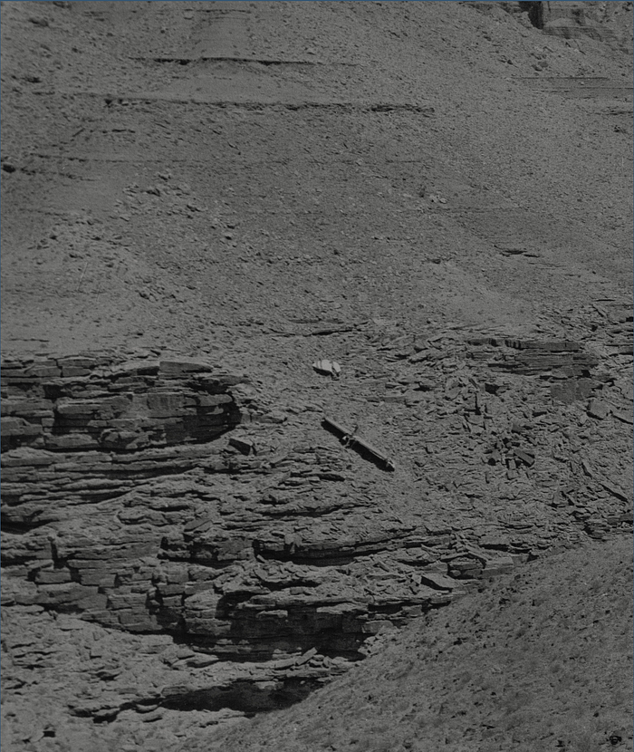
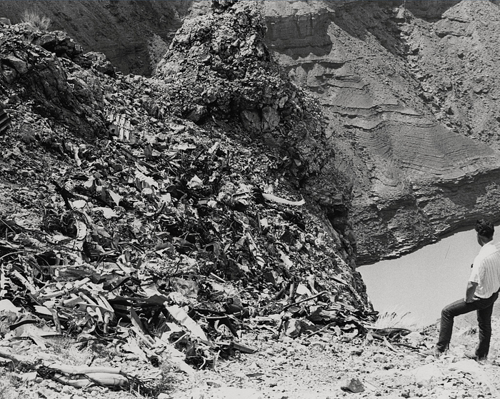
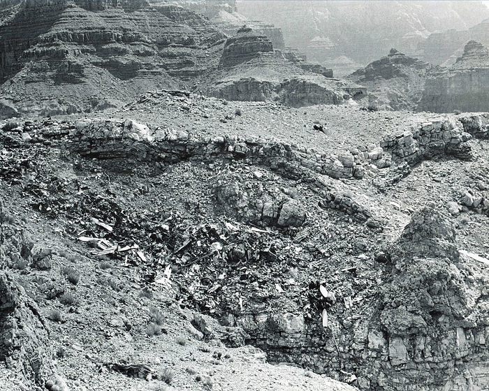
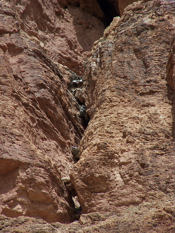
Merely reaching the crash sites would prove to be a major challenge. The Grand Canyon is one of the most rugged landscapes on the planet; there are many places among its soaring plateaus, inaccessible ledges, and precipitous cliffs which have never been touched by human feet. A US Army helicopter was able to land and deposit investigators from the Civil Aeronautics Board (CAB) near the blackened wreckage of the Constellation, which lay in a steep gully running down from the base of Temple Butte, but reaching the DC-7 proved much more difficult. Although a helicopter did manage to land on a nearby ledge in order to confirm that there were no survivors, the operation was extremely dangerous, and authorities did not allow the helicopter to return. Instead, they called in a specially trained Swiss mountain rescue team to climb to the site using ropes and pitons hammered into the sheer face of Chuar Butte. When the mountaineers arrived, they found a scene of utter devastation. Most of the wreckage remained lodged on a treacherous slope near the ledge, trailing away over a 300-meter cliff to the talus fields below, while some debris had been catapulted up and over the promontory before falling down the other side. A significant amount of wreckage and human remains had also become lodged in a vertical crack running up the cliff face below the impact site, a crevice so inaccessible that most of it is still there to this day.

It was immediately obvious to those first men on the scene that none of the 128 people aboard the two aircraft could possibly have survived. The disaster was by far the deadliest commercial air disaster ever at the time, and the first in which over 100 people died, a grim milestone that underscored the increased stakes of aviation safety in a time when more people were flying aboard bigger airplanes than ever before. All across America, people demanded to know: was flying safe? And if it was, how could such a horrific tragedy have occurred?
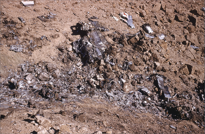
Proving that the planes collided in midair was the first step in answering those questions. This was a relatively simple task: the left wingtip from the DC-7 was found lying next to the Constellation’s severed tail section, away from both wreckage sites, clearly indicating that these parts were severed simultaneously. Paint transfer marks and propeller gouges were then used to establish the angle of contact: the DC-7 had struck the Constellation from behind and to the right, in a nose down attitude (or level with the Constellation in a nose-up attitude, perhaps climbing to a higher altitude) and in a moderate right bank. That was step one.
It was also not terribly difficult to deduce why the two planes ended up on a collision course. Their paths were already expected to cross in that area, and Captain Gandy’s request for TWA 2 to go “1,000 on top” placed the planes at the same altitude as well. Bad luck sealed the deal, as the various turns and detours, perhaps to see the Grand Canyon or to avoid clouds, led them to the same place at exactly the same time.
Some people today, and indeed some at the time, would ask: why didn’t the controller warn the pilots of the danger? For those who worked in the air traffic control industry, it would have been an absurd question. In 1956, air traffic controllers were not responsible for preventing collisions, and were only obligated to provide advisory information about traffic when planes were in controlled airspace. Outside of controlled airspace, controllers did not and could not know the exact position and course of an airplane, and any traffic advisory would be of questionable value. This airspace was also frequently crisscrossed by random VFR aircraft which were completely unknown to air traffic control, further reinforcing the obligation of the pilot to watch out for nearby planes. Besides, Captain Gandy aboard the TWA Constellation had been told about the presence of United 718, but the collision still happened — the point being that controllers, even when they could provide advisory information, did not know enough about the airplanes’ relative positions to prevent a conflict.
In 1956, flight recorders were not installed on commercial aircraft, so it was not possible to say with any certainty why the two crews did not see each other. They were, after all, operating under the principle of “see and avoid,” in which flights in clear conditions are expected to keep a constant eye out for traffic and take any necessary evasive maneuvers.
Essentially all airline traffic in the United States at that time operated under this principle, but authorities had known for many years that its effectiveness in preventing collisions was limited. Numerous factors, many of them beyond the pilot’s control, could influence their ability to see another aircraft in time to avoid it, including atmospheric conditions, obstructions (such as clouds), the relative size and speed of the airplanes, and the workload inside the cockpit. Furthermore, even in ideal conditions pilots could have difficulty spotting an oncoming plane, because an aircraft on a collision course with the observer does not appear to move much relative to the windscreen, making it hard to pick up in one’s peripheral vision. By 1956 studies had already shown that a pilot typically requires 12 to 15 seconds in order to identify another plane as a threat, formulate a response, and execute an evasive maneuver, but interviews with pilots who had survived midair collisions revealed that most of them only saw the oncoming traffic right before impact, or never saw it at all.
It seemed likely, then, that the crew of United 718 — the overtaking aircraft — either never saw the Constellation, plowing into it as it climbed; or saw it too late, and attempted unsuccessfully to dive below it. (Which scenario occurred was open to interpretation, as the wreckage could only reveal the pitch of the planes relative to each other, not to the horizon.) Calculations showed that in perfect conditions, the Constellation would have been visible to them for between 50 and 120 seconds, and the United plane would have been visible to the Constellation’s copilot over a similar period. Nevertheless, neither crew saw the other until it was too late. The CAB couldn’t conclusively say why, but a cloud between the two aircraft was considered the simplest explanation.
The CAB investigators noted that these deficiencies had been understood for many years, but that technological limitations had precluded the possibility of any other system. “This concept has existed as a matter of necessity,” they wrote, “and will continue until there are sufficient technological advances to provide additional assistance to the pilot for collision avoidance. The progress of aviation is moving rapidly toward higher altitudes and greater speeds, with traffic in increasing density. Fully aware of this and its effect, the Board is lending its support to industry, other governmental agencies, and interested persons to find and develop methods, means and devices which will assist the concept of visual separation.”

The Civil Aviation Authority, or CAA, which was at that time responsible for regulating the aviation industry on the federal level, had been trying for several years to upgrade the technology used to control aircraft in US airspace, but the agency was fundamentally limited by its weak mandate and lack of funding. Its capacity to respond fell far short of the scale of the deficiency. A Congressional report had revealed that US airlines were experiencing an average of four near misses every single day, and between 1950 and 1955 there had been eighty midair collisions in the United States. None of these collisions were between two airliners, but experts were well aware of the threat: earlier in 1956, James Lederer, director of the Flight Safety Foundation, had said, “No greater evil could befall aviation than a fatal collision between two large air transports.” Now, it had happened — and demand for change was reaching its crescendo.
The nature of the system, as expert commentators noted, had made a major collision between two large airliners a near certainty. The sky may be big, but it was not big enough for speedy four-engine behemoths to wander all over the United States without any real limitations on where or how high they could fly. The lack of radar outside major airports, the large expanses of uncontrolled airspace, and procedural loopholes like “1,000 on top” gave controllers no means to avert collisions and placed all of this responsibility on pilots who were known to be imperfect monitors of traffic threats even in ideal conditions. Expanding radar coverage to the entire country and empowering controllers to keep airplanes apart was the most obvious solution, but to pay for the additional infrastructure and personnel, the CAA would need more money — a lot more, in fact.
With the flying public already clamoring for change, President Dwight Eisenhower took forceful action. In 1957 he signed the Airways Modernization Act, a law which greatly increased federal funding for upgrading and expanding air traffic control infrastructure. The following year, spurred on by yet another midair collision over southern California in 1958 having claimed a further 49 lives, Eisenhower created the Federal Aviation Agency (now Administration), a new organization which would replace the CAA and would wield much broader powers. The CAA had been a minor branch of the Department of Commerce which did not even report directly to the Commerce Secretary; in contrast, the FAA was created as an independent agency reporting directly to the president, and continued as such until the creation of the Department of Transportation in 1967. Within a relatively short time after these reforms, the days of the “big sky” came to an end, as designated airways with rights of way and radar monitoring came into force across the entire territory of the contiguous United States. Pilots were still obligated to practice “see and avoid,” but now a controller could spot an impending conflict and warn pilots well in advance of where to look for the oncoming traffic.
The successful implementation of these vast reforms would have been in doubt without the work of the Civil Aeronautics Board, which in its final report on the disaster issued a call for the system itself to be overhauled, believed to be the first time an air crash investigation report had ever done so. Indeed, everybody involved in the tragic sequence of events had followed the rules — there was no one to blame but the rules themselves. The changes spawned by the crash snowballed onward for many years, leading to disparate reforms ranging from the abandonment of “1,000 on top” clearances to a breakthrough in negotiations to form a unified air traffic control network for civilian and military aircraft. The changes did not eliminate midair collisions in the United States, but without them, thousands more would have died.
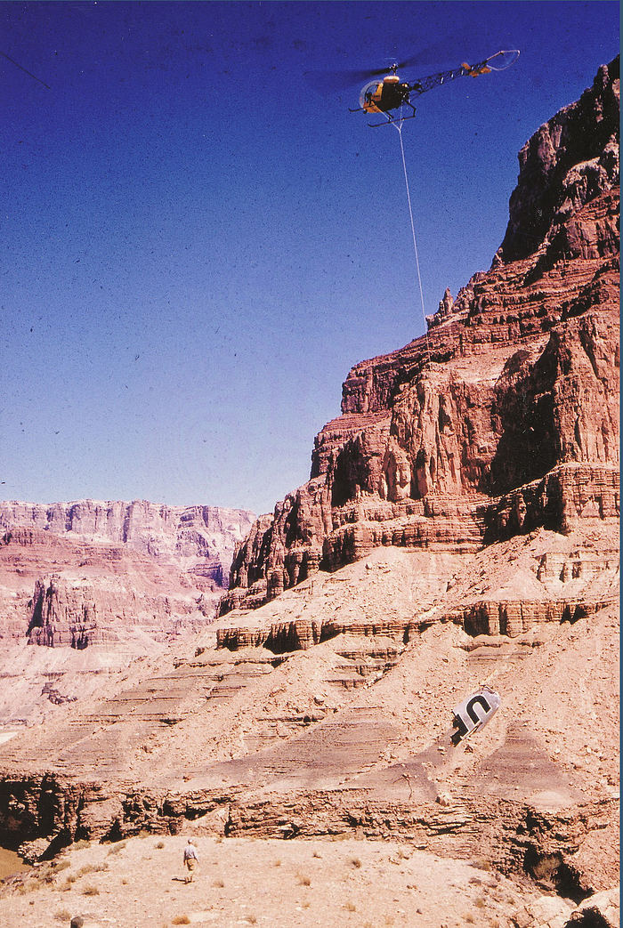
Following the completion of the investigation, most of the wreckage from the two planes was left in place in the Grand Canyon, and for several years the tail of the constellation was visible to rafters on the Colorado River. The National Park Service eventually pushed it into a ravine to keep it out of sight, but travelers on the river continued to stop to visit the crash site on a regular basis, until the Park Service managed to secure funding from the airlines to remove much of the wreckage by helicopter in 1976. But while the largest pieces have been carried away, a substantial amount of debris remains, and anyone willing to make the arduous trek to the crash site can still find countless relics from the doomed airliners, preserved by the canyon’s arid climate. To this day, mangled chunks of metal peer out from the crevasse below the final resting place of the DC-7, and several large pieces of the Constellation lie scattered in the gully where they fell to earth.
Today, the remains of the airliners are considered historic artifacts, and the crash site has been designated a National Historic Landmark. It is illegal to visit or remove debris from the site, although a few intrepid hikers still make their way in every once in a while. But for all the vibrant lives which ended there, and for all the momentous changes which followed, that remote and inhospitable place remains cloaked in eternal silence, broken only by the distant roar of the river and the low drone of the wind. Day after day, year after year, the red walls watch over the graves of so many, unmarked save for in our collective memory, and long will they continue to do so, until the last traces of the events which took place there have been wiped from the barren stones.
_______________________________________________________________
Join the discussion of this article on Reddit!
Visit r/admiralcloudberg to read and discuss over 200 similar articles.
You can also support me on Patreon.
