Plane vs. Tornado: The crash of NLM Cityhopper flight 431

On the 6th of October 1981, a Fokker F28 regional jet operating a domestic commuter flight in the Netherlands encountered a line of thunderstorms shortly after takeoff from Rotterdam. As the pilots attempted to navigate around the building storm, a gap closed in upon them, and the plane was battered by extreme winds. Suddenly, a massive gust slammed into the plane, subjecting it to forces far greater than its design limits. The right wing ripped off in flight, sending the jet tumbling from the clouds over Moerdijk. None of the 17 people on board survived the crash. Investigators wondered: what force could have swatted a plane out of the sky so suddenly? Could turbulence really be to blame? But as the story came together, it became clear that NLM Cityhopper flight 431 had encountered something far deadlier than mere turbulence: in fact, the plane appeared to have flown straight into a tornado that had been cleaving its own path of destruction across the Dutch countryside in the minutes leading up to the crash.

NLM Cityhopper, now known as KLM Cityhopper, is a wholly owned subsidiary of Dutch flag carrier KLM, specializing in short flights within the Netherlands and to neighbouring countries. In the 1980s, NLM Cityhopper operated a fleet consisting mainly of Dutch-made Fokker F-27 turboprops and F-28 regional jets.
NLM flight 431 was a regularly scheduled flight from Rotterdam to Hamburg, Germany, with a stopover in the city of Eindhoven. The plane, a rear-engine Fokker F-28 “Fellowship,” had room for 65 passengers — but on the 6th of October 1981, it was almost empty. Just 17 people boarded the late afternoon flight, including the two pilots, Captain Jozef Werner and First Officer Hendrik Schoorl. Two flight attendants cared for the 13 passengers, who were mostly business travelers from Germany, the United Kingdom, and the United States.

That afternoon, a set of unusual weather conditions were converging on the Netherlands. A stationary warm front lay across much of western Europe, bringing high temperatures and rain to a region stretching from Lisbon to Cologne. Meanwhile, a low pressure zone and an associated cold front was moving east across Ireland. A second low pressure area off the coast of Portugal collided with the warm front, sending a wave propagating up the front and pushing it north into the Netherlands. At the same time, the cold front approached the Netherlands from the west as it passed the British Isles, portending a collision of the two weather systems in the area around Rotterdam. Propelled by high winds at an altitude of around 3,000 feet, the cold air began to pass over the layer of warm air that remained around ground level. Because warm air generally rises and cold air generally falls, a cold air mass on top of a warm air mass is extremely unstable. This instability can generate thunderstorms and other severe weather, including hail, microbursts, or even tornadoes. As the two air masses collided over the Netherlands, lines of thunderstorms sprung up along the convergence zone, strafing Holland and Brabant with rain, high winds, and lightning.

At 4:20 that afternoon, Captain Werner and First Officer Schoorl were informed of the thunderstorms located southeast of Rotterdam during their pre-flight briefing. However, as far as anyone knew, these thunderstorms were not unusual in any way. Weather reports distributed from radar installed at Amsterdam’s Schiphol Airport indicated only light rain and no abnormal wind phenomena. The pilots planned to avoid the thunderstorms if possible, but at that time they certainly had no reason to be worried.
At 5:04, NLM Cityhopper flight 431 took off from Rotterdam airport and turned to the south, climbing out over the city. The latest weather reports at the time still included no mention of any dangerous storms. But in fact, the weather reports given out by controllers in Rotterdam were more than 20 minutes old. Before anyone received the information, a meteorologist in Amsterdam had to observe the state of the weather radar screen, sketch the storms onto a map, and then send copies of the map to airports around the Netherlands, a process which usually took 20 minutes. But in that timeframe, a lot can change.
Although nobody knew it yet, conditions in the area south of Rotterdam were conducive to the formation of extreme cyclonic winds. What happened next was poorly understood at the time, but a probable sequence of events can be reconstructed retroactively using modern knowledge of how tornadoes form.

At the intersection of the two fronts, winds blowing in different directions at different altitudes began to cause the rotation of the layer of air in between them. As the cold air mass above 3,000 feet descended through the lower, warmer air under the force of gravity, the warm air was forced upward, creating updrafts that collided with the rotating layer. The updraft and the spinning “tube” of air merged together, causing the updraft to begin rotating about the vertical axis. This vortex, several kilometers in diameter, is known as a mesocyclone — and if conditions are right, it can rapidly develop into a tornado. However, a mesocyclone is not directly visible on weather radar, which detects the intensity of precipitation. Today, meteorologists can detect mesocyclones by searching for wind patterns revealed using Doppler radar, which can measure the speed and direction of winds within a storm. But in the Netherlands in 1981, the meteorologists putting out weather reports for aircraft had neither Doppler radar nor any particular expertise in mesocyclones and tornadoes. As a result, the mesocyclone forming over the Hollands Diep estuary went completely unnoticed.

Shortly after 5:00 p.m., a tornado began to take shape as the mesocyclone passed near the municipality of Moerdijk on the south shore of the Hollands Diep. A downdraft penetrated the mesocyclone, causing the column of rotating air to descend out of the bottom of the cloud base and toward the ground below. The downdraft progressively constricted the base of the updraft still flowing into the mesocyclone, causing its rotation speed to increase like an ice skater pulling in her arms to accelerate a spin. As the updraft sucked in air at low altitude, it created a low pressure zone that pulled the cyclone further downwards until it reached ground level. The extreme wind speeds precipitated water vapour out of the air, creating a classic funnel cloud around the cyclone. There was no mistaking it — a tornado had touched down in the Dutch countryside, just west of the Moerdijk industrial park! Moving northeast at over 50 kilometers per hour, the tornado tore across farms and fields before ripping straight through the industrial park, sending light debris flying high into the air. As far as tornadoes go, it wasn’t particularly strong — probably not more powerful than an EF1, the second lowest intensity on the 0–5 Enhanced Fujita scale. But even an EF1 tornado can pack wind speeds in excess of 170 kilometers per hour, causing isolated but severe damage to unreinforced structures.

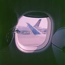
Unaware of the presence of the tornado, the pilots of NLM Cityhopper flight 431 continued flying south toward the Hollands Diep estuary. Five minutes after takeoff, they observed thunderstorms ahead that significantly exceeded the intensity suggested by the last weather forecast. To avoid the worst of the storm, they requested a southerly deviation to fly between the two areas with the most intense precipitation, as shown on their on-board weather radar. The air traffic controller granted the request, and flight 431 aimed for the gap between the two towering anvil-shaped cumulonimbus clouds. As they flew into the gap, clouds closed in around them, and turbulence began to jolt the plane up and down and from side to side. The pilots accelerated to 425kph in an attempt to make the ride smoother.
Meanwhile, numerous witnesses caught sight of the tornado as it passed over the Moerdijk industrial park, including some who reported a second tornado tracking nearby. At the same time, a police officer in a boat on the Hollands Diep chased after the tornado, snapping a series of photos of the fast-moving funnel cloud as he struggled to catch up with it. But despite the large number of witnesses, there was no authority capable of quickly receiving reports of the tornado and passing them on to nearby aircraft.
At precisely 5:12 p.m., as flight 431 passed over the Hollands Diep at 3,000 feet, it crossed paths with the upper reaches of the tornado inside the cloud. Severe turbulence battered the plane, throwing it violently in multiple directions. As the plane approached the vortex, the downdrafts surrounding the tornado slammed it hard from above, smashing into the F-28 with 2.5 times the force of gravity. A split second later, the plane passed through the tornado’s central updraft and into the downdraft on the other side, causing the force to reverse direction twice, from -2.5g to +6.8G to -3.2G, in an extremely short period. The one-two punch of the violent updraft followed by the extreme downdraft exceeded the structural design limits of the airplane, tearing off the right wing and igniting the ruptured fuel tanks.

Missing its entire right wing, flight 431 plunged out of the clouds, corkscrewing down in a halo of fire. There was absolutely nothing that the pilots could do to save their crippled aircraft. The plane plummeted out of the sky and crashed to earth just seconds later on the edge of the industrial park. The fuselage slammed into the side of the perimeter road, sending debris flying over a railroad bridge and across both lanes of traffic. The plane exploded on impact, throwing up a smoke plume that the police officer captured on film just moments after photographing the tornado. Three kilometers away, the severed right wing also fell from the sky, coming to rest in the shallow waters of the Hollands Diep. As for the tornado itself — it dissipated within a minute of the crash, fading away into the evening sky from which it came.

Emergency crews rushed to the scene, but all that remained of the plane was scattered debris and a massive crater in a field. None of the 17 people on board had survived. The crash also indirectly took an 18th life on the ground: a 49-year-old firefighter, upon catching sight of the plane falling out of the sky above him, suffered a heart attack and died on the spot.
Outside of the plane crash, however, the tornado did relatively little damage and no one else was killed or injured. In fact, the connection between the tornado and the plane crash was not immediately obvious. Newspapers in the Netherlands reported that there was severe weather in the area, but made no mention of a tornado, and early speculation largely blamed heavy turbulence or sabotage. But the flight data recorder painted a stark picture: in the space of just a few seconds, flight 431 was subjected to forces ranging from +6.8G to -3.2G, well beyond the structural limits of any airliner. Was the thunderstorm really that intense, or was there another explanation? Investigators needed proof that the plane could have encountered the tornado photographed by the police officer in the minutes before the crash.

Dutch investigators requested an analysis of the tornado from the United Kingdom Meteorological Office in order to assess the probability that it brought down flight 431. By analyzing the photographs, weather maps, flight data, and other resources, the team was able to say with certainty that the Fokker F-28 encountered the upper reaches of the tornadic vortex just after the funnel lifted off the ground near the end of its life cycle. But the report needed to go farther than that. Was the encounter with the tornado a complete fluke, or could more have been done to prevent the accident?

The problem faced by the aviation industry in 1981 was that there was no reliable way to detect tornadoes except to visually observe them from the ground and report their position. Pilots could not be counted on to see a tornado and steer clear because only the bottom tip of the tornado is visible. Experienced meteorologists could identify areas of likely tornado formation by looking for hook-shaped radar echoes on the edges of storms, but this technique, while widely used by storm chasers in North America, was relatively obscure in Europe at the time. In fact, a review of radar data at the time of the accident showed a distinct hook in the area where the tornado formed, but the significance of this was not appreciated until after the accident.
Overall, European authorities seemed ill-prepared to deal with the threat of severe weather. Although tornadoes in North America are much stronger on average, data shows that many areas of Europe experience tornadoes at a similar rate per unit area as the US and Canada. Because most of them are weak, they do relatively little damage, and research into them had lagged behind those in America. But as the Moerdijk tornado demonstrated, it doesn’t take an EF5 to bring down an airliner. So, considering the number of tornadoes that occur worldwide, how likely was it that another plane would find itself in the same situation as NLM Cityhopper flight 431? In its report, the Meteorological Office stated that an encounter between an airliner and a tornado could happen approximately once ever 300 million flight hours — certainly rare, but not so rare that it didn’t need to be thought about. What Europe needed, they wrote, was some system to detect tornadoes or other severe wind events — because as things stood, Europe didn’t have a system at all.

For the purposes of aviation safety, detecting a tornado isn’t that different from detecting any kind of wind shear — that is, wind moving in different directions over a small geographical area. Tornadoes are essentially just a very dramatic manifestation of wind shear, a problem which had been causing crashes for years. At the time, the best advice regulators could give to pilots was to avoid thunderstorms on principle. But this was not a panacea. The pilots of NLM flight 431 did their best to avoid the thunderstorm over Moerdijk, flying around the most intense part of the cell. However, tornadoes often form adjacent to the centre of the storm rather than directly beneath it. Little did they know that by skirting around the edge, Captain Werner and First Officer Schoorl put themselves in even greater danger!

Over the next several years, the problem of wind shear moved to the forefront of global interest due to two fatal accidents in the United States, both of which involved microbursts — a sudden, powerful downdraft associated with a thunderstorm that can push a plane into the ground. In 1982, Pan Am flight 759 encountered a microburst on takeoff from New Orleans, causing the plane to crash into a residential area. All 145 people on board and 8 on the ground were killed. Three years later, Delta flight 191 crashed short of the runway after encountering a microburst on final approach into Dallas, killing 136 of the 163 people on board as well as one on the ground. These crashes spurred the Federal Aviation Administration to invest heavily in technology to detect wind shear from on board the plane.

The technology to detect wind shear from a centralized point on the ground in fact already existed. In 1973, the US National Severe Storms Laboratory (NSSL) for the first time documented the entire life cycle of a tornado using Doppler radar, which measures changes in the frequency of a returning radio signal to determine the speed of airborne particles inside a cloud. This technology was already being employed on some military aircraft, but had only just begun to be applied to civilian uses. By 1981, Doppler weather radar had entered service to detect severe storms in the United States, but Europe lacked any similar program. A few airports, such as London Heathrow, had systems that could detect wind shear near the runways, but most of the continent had no such coverage. At the time of the crash, meteorologists in the Netherlands were still looking at a basic precipitation map, drawing what they observed, and distributing the sketches to airports! In its report, the Meteorological Office wrote to its Dutch counterparts, “It is the view of the authors that some service which alerts aviation to the possibility of severe storms and which might operate on a similar basis to the wind shear alerting service at Heathrow (but with access to a suitable radar display) would be better than no service at all.” In its own report, the Dutch investigators also recommended the establishment of a program that would alert pilots and air traffic controllers to the presence of severe weather in a timely manner. It also recommended that regulators study the possible implementation of a European-wide thunderstorm warning system assisted by new detection technologies.

By the end of the 1980s, two major developments occurred in the fight against wind shear. In 1988, the United States rolled out a system of Doppler radars that would provide almost complete coverage of the entire country, allowing meteorologists to quickly and accurately detect all tornadoes and other severe weather events as they occurred, and to predict them in advance. Around the same time, the FAA successfully developed a wind shear detection system that could be installed on passenger airliners. Such systems were mandated in the United States in 1993, and that same year, Canada completed its own nationwide Doppler radar network. European countries followed suit in the late 1990s, and most achieved complete coverage by 2004. During that time, no other planes flew into tornadoes, and thanks to modern detection systems, such an encounter today is nearly impossible to imagine. NLM Cityhopper flight 431 remains, and likely will always remain, the only confirmed case of a plane crash caused by a tornado. The impact that this specific accident had on aviation safety is difficult to assess, but such a unique event deserves not to fall into complete obscurity.
__________________________________________________________
You’re welcome to join the discussion of this article on Reddit, as well as to visit r/admiralcloudberg, where you can read over 120 similar articles!