Natural Points of View: The story of the 1986 Grand Canyon Midair Collision

On the 18th of June 1986, a chartered helicopter and a twin-engine sightseeing plane collided while flying inside Arizona’s Grand Canyon, sending both aircraft plummeting onto a remote plateau thousands of feet below the canyon rim. The fiery crash killed 25 people and called into question the safety of the Grand Canyon’s booming air tour business. Had the 50-million-dollar industry pushed things too far? How could two aircraft collide in perfect weather and unlimited visibility? As the National Transportation Safety Board pieced together the minutes, days, weeks, and years before the disaster, it became apparent that the collision was born from an overlapping series of long-running disputes over airspace rules, operational concerns, regulatory authority, and environmental impacts, which created competing interests among the various companies and federal agencies operating in Grand Canyon National Park. As these various parties worked against each other, an ill-fated decision was made to move the route of the helicopter tours, causing it to cross the usual route flown by the scheduled carrier Grand Canyon Airlines. The result was a catastrophe which led to an overhaul of the way flights are conducted in National Parks — but which only added fuel to the ongoing fire surrounding noise pollution in the Grand Canyon, an issue that still stirs debate today, as the same interests continue to seek a balance between business, safety, and the natural environment.
◊◊◊

The Grand Canyon has been called America’s greatest natural landmark, one of the seven natural wonders of the world, a sight whose grandeur has taken the breath away from successive generations of visitors. The canyon is no mere hole in the ground: 446 kilometers (277 miles) long, more than a mile deep, and up to 29 kilometers (18 miles) wide, the canyon resembles an inverted mountain range, descending into the earth in a dizzying series of cliffs, gorges, ledges, pillars, and buttes, painted in myriad hues from sun-bleached white through shades of orange to striking vermillion. Its vast scale bewildered Spanish explorers just as it does tourists today, as they gaze out across a tortuous panorama of mind-bending landforms as yet untouched by humankind. And down in the bottom, barely visible from the rim, is the mighty Colorado River, which — perhaps contrary to popular belief — did not carve its way down through a vertical mile of rock, but rather stayed put as the terrain rose from beneath it, an observation first made by the explorer John Wesley Powell in his attempts to explain why the river flowed straight through mountains and plateaus seemingly without regard for the path of least resistance.

Drawn by accounts of the canyon’s incredible beauty, early 20th century tourists began flocking to the Grand Canyon shortly after its designation as a National Park in 1916. It would not be long before local businessman J. Parker Van Zandt got the excellent idea of showing tourists the famous view from the air, and in 1927 he founded what would later become Grand Canyon Airlines, which bills itself as the world’s oldest continuously operating air tour company. Although Grand Canyon Airlines was the first, many others followed, mostly based out of Grand Canyon National Park Airport, located in the town of Tusayan 11 kilometers from the South Rim.
By 1986 the air tour industry in the Grand Canyon had ballooned to 44 operators who collectively carried 350,000 to 400,000 passengers a year and raked in $50-$80 million in annual revenue. During daytime in the peak summer tourist season, a Grand Canyon air tour flight was taking off every two and a half minutes.
However, by the 1970s it had already been recognized that the sheer volume of traffic over the canyon was interfering both with the visitor experience and with the natural environment, which the Department of the Interior’s National Park Service was ordained by Congress to protect. The biggest problem was noise: in parts of the canyon, including some major tourist sites, the sound of aircraft was near constant. Complaints filed by visitors were increasing, and environmentalists were becoming concerned about the impact on wildlife, such as the peregrine falcon, the world’s fastest bird, which nested in the canyon within sight of major air routes. In 1975, Congress got involved, attaching a provision to the Grand Canyon Enlargement Act which asked the National Park Service (NPS) to determine whether air traffic was causing any “injury to the health, welfare, or safety of visitors to the park,” and to study whether the noise had “a significant adverse effect on the natural quiet and experience of the park.” The Act also requested that the NPS make recommendations based on its findings and submit them to the Department of the Interior, which would forward them to the appropriate agencies.

In 1981, the NPS began to study the issue, and by 1984, park authorities had identified aircraft noise as their top resource management issue, although a comprehensive environmental impact study had not been completed. In 1985, the NPS released its preliminary findings and proposed recommendations for public comment, including several options for various plans to restrict aircraft operations in the canyon through the use of minimum altitudes and designated “flight-free” zones. However, the NPS had no authority to regulate where and when aircraft could fly, as this was the responsibility of the Federal Aviation Administration. Only if the FAA adopted the NPS’s recommendations would restrictions be mandated.
The FAA, for its part, had already acknowledged concerns regarding aircraft activity in wild areas such as National Parks. In 1984, the agency issued a non-binding advisory circular strongly urging pilots not to fly fewer than 2,000 feet from terrain in various wild places, including National Parks, federal Wilderness Areas, and more. But the advisory circular did not have any regulatory force, and at the Grand Canyon, it was essentially ignored. Notably, the South Rim of the canyon sits at about 7,000 feet above sea level (2,100 m), and the North Rim rises even higher, to 8,000 feet (2,400 m). Since the performance of the small aircraft used in air tour operations decreases substantially with altitude, attempting to fly 2,000 feet above this already quite elevated terrain would leave some operators unable to carry full passenger loads. Besides, most operators advertised flights within the canyon itself, and flying below the rim was considered a major part of the experience which air tour companies were unlikely to give up voluntarily.
Nevertheless, as the studies neared completion, the Grand Canyon air carriers anticipated that some of the National Park Service’s proposed restrictions would probably be implemented, and they took steps to prepare. In February 1985, for example, the Grand Canyon Flight Operators Association, an informal industry group, distributed a letter to all member companies warning of increased noise complaints near Hermit’s Rest, a popular viewpoint on the South Rim (near Pima Point on the map below). The letter stated that further noise complaints would be “much to the detriment of our status with the NPS,” and advised air carriers to avoid flights over Hermit’s Basin. These efforts continued over the next year, as the Grand Canyon Flight Operators Association repeatedly asked various companies to alter their routes out of the NPS’s proposed “flight-free” zones. Their belief apparently was that if they voluntarily complied with the proposals, the NPS would be less likely to seek official restrictions on other aspects of their operations.

On April 1st, 1986, the Association requested that a particular helicopter tour operator move its point of entry into the canyon from Shoshone Point to Kachina Point, and its exit location from Pima Point to Cocopa Point, in order to keep the helicopters away from the most popular tourist overlooks, where the NPS was considering restrictions.
Two months later, on June 1st, the director of this same tour operator launched a new company, called Helitech, which planned to specialize in on-demand sightseeing flights. The new company began operations with two Bell 206B helicopters, one full-time pilot, and two seasonal pilots, with a third helicopter and fourth pilot scheduled to be added shortly. These helicopters began operating immediately on a non-scheduled basis, taking off as soon as at least three passengers had booked tickets. The company did not yet have its own operations manual, so it simply inherited the previous operator’s route, shown above.

Helitech was registered as a tour operator under Part 91 of the Federal Aviation Regulations, which generally applies to private, non-revenue flights. Many small carriers are registered instead under the more restrictive Part 135, which applies to charter companies and air taxis, while scheduled commercial airlines fall under Part 121, the most restrictive category of all. Each category comes with different safety requirements and levels of regulatory oversight. Although most air tour operators at the Grand Canyon were registered under Part 135, a carveout in this regulation allowed aerial sightseeing flights to operate under Part 91, provided that they returned to the same airport from which they took off, and remained within 25 miles of that airport throughout the flight. Because Helitech’s standard route began and ended at the heliport in Tusayan and never went more than 25 miles from that point, the company was not required to receive Part 135 certification and oversight. The company director wanted to seek this certification anyway, but was told by the head of the FAA’s Las Vegas field office that it would be three months before he could even look at an application.
Grand Canyon Airlines, on the other hand, was certified under Part 135, its pilots were trained to Part 135 standards, and it possessed an operations manual, a requirement under Part 135 but not under Part 91. However, 90 to 95% of the airline’s flights were carried out under the Part 91 carveout because they stayed within 25 miles of Grand Canyon National Park Airport, and only occasional point-to-point charter flights from the South Rim to the North Rim were operated under Part 135.

Grand Canyon Airlines was a larger operator than Helitech, with a fleet of two Cessna 207s and two much larger de Havilland Canada DHC-6 Twin Otter “Vistaliners.” The DHC-6 Twin Otter is a twin-engine, high-wing turboprop airplane known for its performance in rugged conditions, ideal for sightseeing flights in the Grand Canyon. This application of the type proved so popular that a Las Vegas-based company produced a special variant, called the Vistaliner, specifically for air tour operations, which was distinguished from the unmodified DHC-6 by its extra-large windows and air conditioning system. All of Grand Canyon Airlines’ DHC-6s were Vistaliners, and this remains true today.
The airline drove its DHC-6 fleet hard, with a scheduled tour departing every hour during the peak summer tourist season. Capable of carrying 19 passengers and two pilots, the planes were the largest aircraft typically flying in the Grand Canyon, and when business was hopping they were usually full. These flights roughly followed a standard route (shown later in this article) which ran counterclockwise in the morning and clockwise in the afternoon in order to take better advantage of the shifting light on the canyon over the course of the day, a practice shared by every other carrier as well.
◊◊◊

On the morning of June 18th, 1986, 18 passengers gathered in the terminal at Grand Canyon National Park Airport for a regularly scheduled sightseeing flight on board a Grand Canyon Airlines DHC-6 registered as N76GC. Known by its callsign “Canyon 6,” the plane was piloted that day by Bruce Grubb and Jim Ingraham, both 27 years old and both qualified Captains with several years of Grand Canyon experience. One pilot would have focused on flying the plane while the other read certain checklists and narrated the flight to the passengers, pointing out major landmarks; which pilot played which role on this particular flight is uncertain, but it is known that Grubb was in the left seat acting as Captain, while Ingraham occupied the right seat, acting as First Officer.
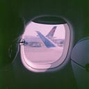
After taking on the 18 passengers, which included four Americans, 11 Dutch nationals, two people from Switzerland, and one from South Africa, Canyon 6 departed the airport at 8:55 a.m. and climbed away into perfectly clear skies. Minutes later, it passed Kachina Point and descended into the Grand Canyon, crossing the Colorado River on its way toward the North Rim as awestruck passengers snapped photographs through the windows.

Minutes later, at 9:13, a Helitech Bell 206B helicopter, callsign “Tech 2,” departed the heliport in Tusayan with four West German tourists on board. In command was 39-year-old John Thybony, Helitech’s only full-time pilot and a veteran both of Grand Canyon flying and of the Vietnam War, where he had earned commendations. He had been hired only five days earlier, coming straight from another helicopter tour operator, but he was perfectly familiar with both the aircraft and the route, which would take him close to the canyon walls near some of the park’s most significant landmarks.
As the two aircraft proceeded into the canyon, they tuned in to a common radio frequency used by Grand Canyon tour operators to keep apprised of each other’s positions. Because radar couldn’t see down into the canyon, the airspace inside was uncontrolled and pilots were responsible for their own navigation and collision avoidance. Most operators therefore used the common frequency on an informal basis in order to report passing certain landmarks, although the exact reporting points varied from one company to the next. Grand Canyon Airlines normally had its pilots report passing Kachina Point, Angel’s Gate, Shiva Temple, Dragon’s Head, Holy Grail Temple, Wheeler Point, Havasupai Point, the Scorpion, Crystal Rapids (optional), and Cocopa Point, while the Helitech reporting points were Kachina Point, Phantom Creek, Shiva Saddle, Dragon’s Head, the Ancestral Puebloan ruins, Mencius Temple, and Crystal Rapids. The fact that the two companies’ reporting points were not the same even in the areas where the routes overlapped reflects the informal nature of the system in place at the time.

Little is known about what happened over the next few minutes, because there was no radar data and neither aircraft carried any black boxes. But, assuming both aircraft roughly followed their usual routes, by 9:25 or so Canyon 6 would have turned around at the west end of the tour near Wheeler Point, while Tech 2 would have been approaching the Ancestral Puebloan ruins, located near Point Sublime. Sometime before 9:30, another pilot heard Canyon 6 report passing Havasupai Point, presumably eastbound, soon to be headed upriver toward the Scorpion and Crystal Rapids. Minutes later, at about 9:30, the same pilot heard Captain Thybony on Tech 2 report, “West of Mencius at 6,400 feet, southbound.” That meant that the helicopter had passed the Ancestral Puebloan ruins and had turned almost due south toward Crystal Rapids and Cocopa Point, where it would exit the canyon.
As shown on the above map, with the two companies’ routes overlaid, it becomes apparent that in the area around Mencius Temple and Crystal Rapids, Tech 2’s usual route crossed that of Canyon 6. Unlike other parts of the route, where Helitech and Grand Canyon Airlines aircraft simply followed each other up the same drainages, this area represented a unique point at which the two flight paths crossed at an angle close to 90 degrees. Furthermore, there was no assurance of altitude separation, because while both companies used suggested altitudes at various points on the route, adherence was not enforced, and planes and helicopters could realistically be encountered at any height.

What exactly happened on board Tech 2 and Canyon 6 as they approached the crossing point will never be known for sure. What is known is that Canyon 6 was flying eastbound and had likely begun its wide right turn back toward Cocopa Point, while Tech 2 was flying straight southbound toward Crystal Rapids. Tech 2 had reported being at an altitude of 6,400 feet, within 100 feet of its prescribed altitude for that part of the flight. The standard route for Canyon 6 would have had it climbing from 7,100 to 7,300 feet at that point, but since the elevation of the rim at Cocopa Point was only 6,500 feet, there was no urgent need to achieve these heights, and planes commonly flew lower. In this case, Canyon 6 must have been near 6,500 feet, simply because of what happened next.

At about 9:33, just north of the Colorado River and southwest of Mencius Temple, Tech 2 plowed directly into the left side of Canyon 6 with a tremendous boom. The helicopter’s rotor blades sliced into the DHC-6’s nose landing gear, followed a split second later by the rear fuselage, shattering the plane’s rearmost row of panoramic Vistaliner windows and ripping the tail section clean off the passenger cabin. The helicopter’s main rotor assembly disintegrated violently, throwing blades in every direction, as the DHC-6’s fuel tanks burst and spewed forth a great, white cloud of aviation fuel.
Missing their critical control surfaces, both aircraft pitched steeply downward and rolled inverted, trailing debris as they plunged toward the canyon floor several thousand feet below. There was no time for a distress call. Seconds later, Canyon 6 slammed into the immense base of Mencius Temple and exploded in flames, followed by Tech 2, which came to rest on the wide open Tonto Plateau some 750 meters (2,450 ft) to the southwest.

No one saw the two aircraft collide, but another pilot flying east near Havasupai Point thought he saw a flash, followed moments later by twin smoke clouds rising from the depths of the canyon. At the same time, a group of rafters approaching Crystal Rapids on the Colorado River heard the sound of the collision and looked up to see both aircraft plummeting inverted from a white cloud of fuel, before disappearing from view above the rim of the steep inner gorge. One of the rafters managed to snap a photo of the fuel cloud a few seconds after the collision, before smoke began to rise from the burning wreckage.
Moments after the crash, the pilot of a National Park Service helicopter conducting a supply run to Phantom Ranch at the bottom of the canyon heard a transmission over the common frequency describing the collision and reporting that survivors were walking around near the wreckage. He immediately returned to base, grabbed his medical equipment, and followed the smoke to the crash site. From the air, both aircraft could be seen lying inverted on the relatively flat Tonto Plateau, about 4,000 feet beneath the canyon rim, fully engulfed in flames. Despite the report, he found no sign of any survivors.
◊◊◊

By the time rescuers landed at the crash site, it was clear that none of the 5 people aboard Tech 2 nor the 20 people aboard Canyon 6 had survived. All died instantly on impact, their charred bodies still lined up in the neat rows where they had been sitting, having burned in situ after death. Most of the DHC-6 had also burned away, except for the wings, while the tail section came to rest 290 meters (953 feet) away, cleaved neatly from the fuselage by the helicopter’s main rotor. Pieces of both aircraft were scattered for a considerable distance over rugged terrain, and in fact the collision was so violent that a piece of a rotor blade had been flung nearly a mile from the crash site.
Due to the remoteness of the area, getting National Transportation Safety Board investigators to the scene took more than two days. So inhospitable was the location, so far from any trails or Native American sites, that the Washington Post commented that the crash victims might have been the first humans to touch the ground there. Once investigators got there, they certainly understood why: the heat was unbearable, there was no water, and a veritable forest of cacti and other unfriendly plants carpeted the landscape, ripping their clothes to shreds.

Nevertheless, by piecing together scrape marks, rubber deposits, and paint smears left on the debris, investigators concluded that the Bell 206B helicopter impacted the DHC-6 from the left, severing the plane’s tail section and the helicopter’s main rotor, which irreversibly crippled both aircraft. This finding was consistent with the expected positions of the two aircraft at that point in the flight if they were following their respective standard routes. Furthermore, by applying photogrammetry techniques to the photo of the fuel cloud taken by the rafter, they determined that the collision probably took place between 6,400 and 6,600 feet above sea level.
Unfortunately, however, neither aircraft was equipped with a flight data recorder or cockpit voice recorder, and there were no witnesses to the accident, so it was impossible to determine what the pilots were doing in the moments leading up to the crash. In theory, neither pilot’s view of the other should have been obstructed, and the two aircraft might have been visible to one another for up to a minute before they collided. Furthermore, neither aircraft would have been backlit or shadowed. But for whatever reason, they never saw each other, and the NTSB could only speculate why.

A few related points are however worth mentioning. For one, the DHC-6 may have been beginning its right turn shortly before the collision, which could have caused the helicopter to appear close to the bottom of the left pilot’s window, rather than in the middle. It was not possible to know the attitudes of the two aircraft in the lead-up to the collision, so the NTSB did not conduct a line-of-sight study, but it is worth noting that it could have been somewhat awkward for First Officer Ingraham, seated on the right side of the cockpit, to have seen the helicopter out the left side window while in a right turn. This is potentially significant because Grand Canyon Airlines operating procedures called for the pilot seated on the inside of the turn to search for traffic, presumably in the direction in which the plane was turning, so the probability of spotting an aircraft coming from the complete opposite direction might have been reduced. However, Canyon 6 could not have been in the turn for very long when the collision occurred, given its location, so this can’t explain why nobody spotted the helicopter before then.
The NTSB also noted that Helitech had not fitted its helicopters with intercom systems, because the company believed that these systems would encourage their single pilots to spend more time narrating, which would be distracting. In practice, Helitech pilots were only supposed to point out the Colorado River, Phantom Ranch, and the Ancestral Puebloan ruins, but when they did so, they needed to look behind them toward the rear passenger bench seat, taking their eyes off the sky in front of them. There was no evidence that pilot John Thybony would have been doing this when the collision occurred, given the location, but on the off chance that he might have needed to communicate with a passenger for whatever reason, he would have been unable to do so without looking away from the approaching DHC-6.

Additionally, investigators found that the pilots of Canyon 6 could have been suffering from chronic fatigue at the time of the accident. Operations conducted under Part 91 of the Federal Aviation Regulations were not required to adhere to any duty time limits, and both pilots of Canyon 6 were flying considerably more hours than would be allowed at a commercial airline operating under Part 135 or Part 121. Here the NTSB pointed out a contradiction inherent in the system, which was that Part 91 sightseeing flights were actually more fatiguing than regular scheduled passenger flights, in that they were often conducted in small airplanes without the benefit of an autopilot, sometimes in turbulent conditions close to the ground, while maintaining constant lookout for other aircraft, and yet these flights were the ones without fatigue restrictions. The possibility that fatigue contributed to the DHC-6 pilots’ failure to spot the helicopter therefore could not be ruled out.
Lastly, the NTSB investigated whether the color of the two aircraft could have played any role. Tech 2 was painted yellow and white, while Canyon 6 was white with brown, red, and gold stripes. But given the sheer variety of natural colors within the canyon, it was impossible to say whether either color scheme impacted visibility under the conditions at the time of the accident. The former president of Helitech in fact told the NTSB that no paint scheme was better than any other, and that he had never had trouble spotting aircraft in the canyon, although he also said that he had seen orange helicopters totally disappear against the red canyon walls, a seemingly contradictory statement. In the end, this line of inquiry was inconclusive.

Stepping back for a moment, the fact that visibility was even important testified to the particular conditions of flight in the Grand Canyon — namely, that the airspace was uncontrolled, and the active method of collision prevention was “see and avoid.” Today, these aircraft would be equipped with collision avoidance technology, but in 1986 these systems were not in widespread use, and inside the canyon pilot vigilance was the only means of keeping aircraft apart. At the same time, “see and avoid” is flawed, and always has been flawed, because pilots don’t always see each other, even in perfect conditions, which has been a major cause of midair collisions throughout aviation history. The NTSB’s predecessor cited the inherent shortcomings of “see and avoid” in its report on the 1956 collision of two full-size airliners over the Grand Canyon (with 128 people dead, certainly the more famous “Grand Canyon mid-air collision”), and the agency continues to cite it today, such as in its recently released report on a 2019 collision of two sightseeing flights over Alaska, which killed 6.
However, the limitations of see and avoid can be substantially mitigated through the use of procedural separation. By making aircraft follow standard routes at standard altitudes, it becomes possible to design the routes so as to minimize the risk that any two aircraft will ever be in the same place at the same time. Many Grand Canyon operators had taken steps toward establishing procedural separation on an informal basis by creating standard routes with suggested altitudes, such as those shown earlier in this article. But there were two main flaws with this process: first, the altitudes weren’t enforced; and second, nobody was reviewing the routes to determine whether they were in conflict with one another.

Because pilots faced no consequences for deviating from the suggested altitudes included in their standard routes, it was common practice to fly at whatever altitude each pilot felt they could get away with at that point in the flight. The problem had gotten so bad that, according to a Department of the Interior representative who rode undercover on several sightseeing flights in 1985, some helicopter pilots were even flying inside the inner gorge of the Colorado, as close as 20 feet above the river. The truth was that regardless of what the suggested altitudes were, planes and helicopters could in practice be encountered at any altitude. This fact was illustrated by the crash itself, in which the DHC-6 was apparently flying at between 6,400 and 6,600 feet in an area where its suggested altitude was 7,100 to 7,300 feet, placing it directly in the path of the helicopter.
Without assurance of vertical separation, lateral separation was the only means of procedural separation available. In general, this had worked quite well, since no sightseeing flights had ever collided in the Grand Canyon before 1986. But the timing of the collision was no coincidence — in fact, the NTSB found that it was a breakdown in this system of lateral separation which led directly to the accident.
As seen in the earlier graphics, the old route used by Helitech’s predecessor never crossed that of Grand Canyon Airlines. The routes sometimes overlapped, but they never crossed. Collision risk is greatest at a crossing point, because the aircraft will converge at high relative speed, whereas two aircraft following an identical route will converge slowly if at all. (This is not true if the overtaking aircraft is very fast and the other is very slow, as seen in my earlier article on the crash of PSA flight 182, but it was true enough in the Grand Canyon.) However, when the helicopter tour route was moved in order to exit the canyon at Cocopa Point instead of Pima Point in April 1986, a crossing point was introduced between Mencius Temple and Crystal Rapids, substantially increasing the risk of a collision with Grand Canyon Airlines, given the lack of vertical separation.

When the routes are displayed together on a map, this conflict becomes so obvious that it’s possible to guess where the collision occurred simply by looking at, even with no prior knowledge of the accident. However, while I have produced these handy and colorful maps for your benefit, no one actually made this comparison in 1986. This would have been the job of the FAA, except it wasn’t, because both companies operated their sightseeing flights under Part 91, where they were under no obligation to submit their routes for federal approval. Consequently, while the FAA inspector responsible for Grand Canyon Airlines did review their operations manual as part of their Part 135 certification, she didn’t even look at their sightseeing routes, since those were operated under Part 91. The same applied to Helitech.
The NTSB took time to note that in May 1984, following the crash of a Las Vegas Airlines sightseeing flight in the Grand Canyon, which killed 10 people, the agency had recommended that the FAA examine the procedures used by Grand Canyon operators, including their routes, schedules, and flight altitudes. The FAA responded positively to the recommendation, but after the collision in 1986, the NTSB found no evidence that the agency had actually done anything.
◊◊◊

The NTSB also investigated why the helicopter operators changed their routes in the first place, and found serious problems with the way various parties to the system had been interacting with one another. The change to the route was made because the Grand Canyon Flight Operators Association anticipated that the National Park Service would pursue the creation of “flight-free” zones in certain areas, and because they feared a loss of standing with the NPS, leading to more regulations, if they didn’t comply voluntarily. In effect, this meant that the NPS could announce its intent to pursue regulations, and despite the fact that the agency possessed no actual statutory authority over aircraft operations, the operators were likely to comply. Furthermore, the NPS had not yet consulted the FAA when it announced these intentions, thus unwittingly bypassing the regulatory structures which were supposed to govern air traffic.
In its efforts to reduce noise and protect wildlife, the NPS was simply acting according to its mandate, which was to protect the resources of the park for future generations. The FAA, however, was concerned solely with aircraft safety and ease of operations. While representatives of the NPS and FAA had met multiple times to discuss their concerns, the FAA was reluctant to establish any flight-free zones purely for environmental reasons, which it considered “arbitrary” and not relevant to the agency’s mission. And on top of this conflict were the operators themselves, who were mainly interested in making a profit, regardless of whether that meant appeasing the NPS or trying to fight it. The result was a milieu of competing interests, with the NPS caught in the middle, as the tour operators sought to avoid new regulations while environmental groups pressured for changes, including the Sierra Club, which filed suit against the Department of the Interior and the Department of Transportation in May 1986 in order to force a timeline for regulating air traffic in the Grand Canyon.

The general environment of Grand Canyon operations clearly indicated that safety regulations, while not the purview of the NPS, were certainly overdue. The safety record in the Grand Canyon was decent, if not quite at the level of the airlines, but this record was held together by informal practices surrounding routes, altitudes, and radio calls. That made it vulnerable to errors, like the change to the helicopter tour route, which would not occur in a regulated environment. This risk was compounded by the sheer volume of traffic — around 350 aircraft entered the Grand Canyon every day during the peak season, while operating under rules designed for remote, uncrowded airspace. In the NTSB’s view, this was a recipe for disaster.
After the crash, the question became what to do about the problem. The NTSB proposed requiring sightseeing flights to operate under Part 135 everywhere, although one NTSB board member argued that this restriction should only apply to the Grand Canyon, and most other parties agreed. As a result, the FAA revoked the exemption allowing sightseeing flights in the Grand Canyon to operate under Part 91, forcing these companies to develop operations manuals containing established routes and altitudes subject to FAA approval. Furthermore, the FAA created a Special Flight Rules Area extending from the canyon floor to an elevation of 9,000 feet, within which even transient Part 91 traffic was not allowed, along with other requirements, such as the use of a common frequency and mandatory position reports.
As for the specific companies involved, no particular sanctions were levied, and Grand Canyon Airlines is still around today, now with a much larger fleet of 13 Vistaliners. Helitech was not so lucky: having suffered an accident just two weeks after its founding, the company’s insurance carrier got spooked and pulled its coverage, forcing it to cease operations.

The United States Congress took action as well. In 1987, the National Parks Overflights Act was signed into law, mandating the creation of flight-free zones in National Parks, prohibiting sightseeing flights inside the Grand Canyon below the level of the South Rim, establishing curfews, and creating a cap on the number of flights which could be conducted over the canyon annually. Arizona Senator John McCain, a sponsor of the bill, even proclaimed upon its passage that, “The Grand Canyon does not exist for anyone’s financial benefit.”
Nevertheless, the original dispute which caused the crash — the argument over the problem of noise in the canyon — continued for decades. So did the lack of trust between all the parties involved. Robert Arnberger, the Superintendent of Grand Canyon National Park from 1996 to 2000, described working with the FAA as being “like having a root canal.” And air tour operators lashed out at environmentalists, accusing them of elitism: many of their clients, they argued, were elderly or infirm, and why should they have any less right to see the canyon up close than those who could make the arduous trek to the bottom? This debate over access has surrounded the parks since their inception. If you want to learn about the exclusionary viewpoint, I suggest reading Edward Abbey.

In the end, the NPS’s studies of aircraft noise in the Grand Canyon dragged on well into the 2000s, ultimately resulting in an environmental impact study more than 1,000 pages long. However, in 2012, shortly before its publication, the same John McCain who sponsored the National Parks Overflight Act inserted a rider into unrelated legislation which shelved the inquiry and watered down the cap on flights which he himself had voted for, allowing air tour operators to omit flights in the first 25% of the year from their total if they adopted “quiet aircraft technology.” The effects of this change are uncertain. In 2015, a representative of the Sierra Club lamented that the canyon was just as noisy as it was in 1986, because the cap on annual overflights had reached 93,000 — an increase which may have offset advances in noise reduction technology. At the same time, NPS data show that aircraft noise was already decreasing between 2017 and 2019 before dropping to record low levels during the pandemic. Post-pandemic data are not yet available.
Noise is one thing; safety, however, is another. The regulations introduced after the 1986 crash measurably improved the safety of flight operations inside Grand Canyon National Park, but a substantial portion of the industry now operates out of Hualapai tribal land at the west end of the canyon, where the restrictions don’t apply. Several crashes have occurred there since the turn of the century.

The truth is that safety can only be achieved if everyone works together and follows the rules. When it comes to complex airspaces like the Grand Canyon, a regulatory framework is necessary to prevent problems like the April 1986 flight route change from slipping through the cracks. That means that as much as they might hate each other, the NPS, FAA, tour companies, and interest groups like the Sierra Club need to sit down and work things out within that framework whenever the need for change arises. Otherwise, people will start making decisions with knock-on effects outside their area of expertise, which can cause unanticipated harm to both people and the environment.
Some might find it tempting to use the crash to disparage these environmental concerns, and indeed this argument was employed in the aftermath of the disaster to point the finger at activists rather than examining the real root cause. But while we should always care about flight safety, we should also sometimes take a step back and consider the bigger picture. If we bequeath to our grandchildren a world with no peregrine falcons, simply because we ran aircraft through their nesting areas in our pursuit of a better view, we will have failed in our role as stewards of the land. In that respect, John McCain was correct: the canyon isn’t there for anyone’s financial benefit. Being able to fly over the Grand Canyon is a privilege, not a right, and with that privilege comes a responsibility not only for the passengers aboard the aircraft but for the land itself and the creatures that live on it. These responsibilities don’t have to be at odds with one another, but in 1986 they were placed at odds by a lack of cooperation, structure, and oversight. The collision didn’t happen because we tried to save the birds — it happened because we created a dangerous system, and if we can’t make that system safe, then maybe the birds deserve the airspace instead. After all, they were there long before us, and hopefully they will continue to be there long after we’re gone.
_________________________________________________________________
I would like to extend special thanks to Michael McComb, whose website “Lost Flights” is the source for the majority of the photographs used in this article. You can read his account of his aviation archaeology expedition to the crash site here: https://www.lostflights.com/Grand-Canyon-Aviation/61886-Grand-Canyon/
_______________________________________________________________
Join the discussion of this article on Reddit
Support me on Patreon (Note: I do not earn money from views on Medium!)
Visit r/admiralcloudberg to read and discuss over 240 similar articles